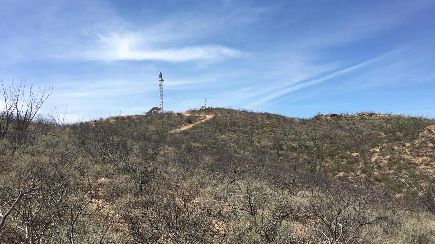
 VIEW LARGER One of the U.S. Border Patrol's integrated fixed towers built on a hill in Cochise County.
 U.S. Customs and Border Protection is aggressively expanding a “virtual wall” of border surveillance towers in the Southwest, according to the Electronic Frontier Foundation, which is mapping the locations of each tower along America’s southern border.
“We started creating our own map, and it became clear that this would be a useful resource for other people, including journalists, researchers, advocates, and humanitarian workers,” said Dave Maass, director of investigations at the foundation, a nonprofit dedicated to protecting civil liberties in the digital age.
Maass said the project began in 2022 when EFF was traveling across the border to document surveillance towers and realized there weren’t any public maps of their locations. They found the towers not only in remote areas but in neighborhoods and inhabited urban locations.
EFF said in a previous statement that digital surveillance at the U.S.-Mexico border “doesn’t just affect migrants,” but all Americans who live within 100 miles of a land or sea border “putting them in the constant shadow of billions of dollars worth of privacy-invading technology.”
Requests for comment from CBP on the operation of the towers and safeguards against their potential abuse were not immediately returned.
The map — so far pinpointing 352 towers in California, Arizona, New Mexico, and Texas — depicts only a portion of what’s installed and what’s to come and will be updated as new information becomes available. EFF is also concerned about the increasingly sophisticated surveillance systems that use artificial intelligence.
EFF said CBP is placing new smaller AI-controlled surveillance towers along the border in southern Texas and parts of California that catalog images, and CBP is working to integrate its towers by different manufacturers into one program.
EFF said its map includes surveillance towers — both fixed and moveable — adopted by CBP over the last decade from several vendors: Elbit Systems of America, General Dynamics, Anduril Industries, and FLIR.
“They are pushing a new program called the integrated surveillance program which could bring the Elbit systems and the General Dynamics systems and the Anduril systems under one specific program within CBP,” Maass said.
Arizona was an early adopter of surveillance towers when the CBP program was launched in the 2000s, so most of the new towers are in neighboring states.
“Arizona was the starting point, and spending spiraled,” Maass said.
Researchers in Arizona are among those who may benefit from the new map.
Sam Chambers, a researcher at the University of Arizona’s School of Geography has analyzed the spatial and temporal patterns of border crossers and the mortality of these crossers in comparison to the border regulations and border surveillance in place.
Chambers’ research shows a correlation between surveillance towers and migrant deaths.
“Before and after surveillance tech was installed, the locations of human remains found have been in different places,” Chambers said, explaining surveillance towers force migrants to take a different route, which is often more dangerous due to weather and geography.
“Each new development will multiply the harm and multiply the deadliness of the border,” Chambers said.
The increase in these surveillance technologies not only affects the border crossers but the residents living in cities where the towers are located.
According to EFF’s map, some cities and towns — including Nogales and Douglas, Ariz., and San Antonio, Texas — appear to have a concentration of surveillance technology, which brings up privacy concerns for Pedro Rios, director of the U.S./Mexico Border Program for the American Friends Service Committee.
Towers in these areas pick up a lot of motion from people living their day-to-day lives, said Rios, adding motion detected from people leaving for work, walking their dog, or going to the mailbox could all be tracked by these surveillance technologies.
“I think with any type of enforcement mechanism or tool, there has to be methods of ensuring accountability put in place and that there is an oversight on these mechanisms and transparency, and it seems these three things are missing,” said Rios.
Rios said surveillance systems on the border collect endless data on U.S. citizens, and it is important that this data has a proper oversight mechanism to ensure that agencies are held accountable for any misuse and citizens’ basic civil liberties.
Like Chambers, Rios is also concerned about any correlation between surveillance towers and migrant deaths.
“Studies have shown the impact on border crossers, and there is a correlation between the placement of the towers and — specifically in southern Arizona — the location of human remains being found,” Rios said.
By submitting your comments, you hereby give AZPM the right to post your comments and potentially use them in any other form of media operated by this institution.